































Table of Contents
- Key Points
- Introduction to AI-Powered Architectural Mapping
- Step-by-Step Guide to Creating Architectural Mapping Diagrams with Aino
- How to Use Aino
- Aino Pricing Structure
- Evaluating Aino: Pros and Cons
- Aino Key Features
- Practical Applications of Aino in Architectural Projects
- FAQ
- Related Questions


Introduction to AI-Powered Architectural Mapping
The Rise of AI in Architecture
The integration of AI in architecture is transforming how projects are conceived, planned, and executed. AI Tools provide unprecedented capabilities for data analysis, visualization, and design optimization, leading to more efficient and innovative outcomes. Architectural mapping, a crucial aspect of urban planning and architectural design, benefits significantly from AI's ability to process and interpret complex spatial data. This allows professionals to make informed decisions based on accurate and comprehensive information, ultimately leading to better designs and more sustainable urban environments. Embracing AI in architectural mapping not only boosts productivity but also facilitates data-driven decisions, ensuring that projects align with community needs and environmental considerations.
Architectural mapping traditionally involved manual data collection, which was time-consuming and often prone to inaccuracies. AI offers tools that automate this, significantly speeding up the process. By using AI, professionals can achieve highly accurate and sophisticated visualizations, leading to better resource allocation, optimized designs, and enhanced urban development.
What is Architectural Mapping?
Architectural mapping involves creating visual representations of spatial data related to buildings, infrastructure, and the environment. These maps are essential for urban planning, architectural design, and real estate development. Traditionally, architectural mapping relied on manual surveys and Geographic Information Systems (GIS), which could be time-consuming and resource-intensive.
However, AI is now revolutionizing this field by automating many of these tasks. AI algorithms can process satellite imagery, aerial photographs, and other data sources to generate highly accurate maps quickly. This enhances decision-making processes and opens new possibilities for sustainable and efficient urban development.
Benefits of Using AI in Architectural Mapping
Integrating AI into architectural mapping provides numerous advantages:
-
Increased Efficiency: Automating data collection and analysis saves significant time and resources.
-
Enhanced Accuracy: AI algorithms minimize errors and provide precise spatial data.
-
Data-Driven Decisions: Access to comprehensive datasets enables informed decision-making, promoting sustainable and efficient urban development.
-
Improved Visualization: Sophisticated AI tools create detailed and informative maps, enhancing project communication and collaboration.
-
Cost Savings: Reducing manual labor and optimizing resource allocation can lead to significant cost savings.
-
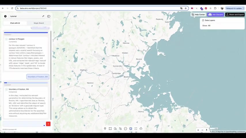
Better Designs: By deeply understanding the context, architects can craft designs that respond effectively to community needs. AI allows architects to extract data such as boundaries of a city and use that Prompt to generate a precise polygon of the area. This precision allows greater focus on design.
Step-by-Step Guide to Creating Architectural Mapping Diagrams with Aino
Getting Started with Aino
Aino.world provides a user-friendly platform for creating architectural mapping diagrams using AI. The process is straightforward, allowing professionals to leverage AI's power without extensive technical expertise.
Here's a step-by-step guide to get you started:
- Outline Geographical Boundaries:
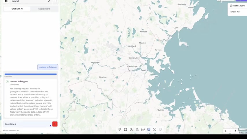
Begin by defining the area of interest. For example, if your project is in Boston, Massachusetts, type in the boundary of Boston as a prompt. The AI will extract the relevant data to generate a precise polygon of the area.
- Edit and Customize: Once the polygon is generated, you can edit the outline stroke, adjust the fill color, change the fill opacity, or apply a fill pattern. The system works similarly to GIS, offering flexibility in map customization.
- Zoom and Outline Specific Areas: Zoom into your design site area and ask the AI to outline specific areas, such as downtown Boston. This helps to create a detailed view of the area and its surroundings. Renaming the layer helps you to use this area as a prompt later.
- Test Different Base Map Styles: Experiment with different default base map styles to find one that best suits your visualization needs. An aerial photo can provide a better view of your design site, highlighting key features and structures.
- Define Design Area: Drop a pin on your design site and define a radius around it to mark the design area. This helps to focus your analysis on the immediate surroundings of your project.
- Extract Green Spaces: Use AI to identify and extract green spaces within the defined zone. This helps in understanding the environmental context of your design site. It is essential that you define a radius before attempting to define your design area.
- Analyze Polygon Areas: By clicking on a polygon area, such as a green space in the center, you can view detailed dataset information about that area, saving valuable time for research and analysis. Also it is possible to duplicate an area, isolating the area and creating a new polygon.
- Extract Roads and Buildings: Enter prompts to extract roads and buildings within the radius area. The AI will identify and map these features, providing a comprehensive view of the urban fabric.
- Customize Building Footprints: Display buildings in black to create a clear and professional building footprint diagram. This enhances the visual clarity of your mapping presentation.
- Export the File: Once you have gathered all the mapping data you need, export the file as a DXF. This vector file format is commonly used to share 2D and 3D designs between software like CAD, SketchUp, or Adobe Illustrator.
Aino Pricing Structure
Understanding Aino's Subscription Plans
Aino offers a range of pricing options to accommodate different needs and budgets. These options typically include free trials and subscription plans. Here’s a summary of what you can expect from their offerings:
- Free Trial: Test Aino with basic features before committing to a subscription.
-
Subscription Plans: Aino's subscription plans may include the following tiers:
- Basic: Ideal for personal use and small projects, with limited features and data access.
- Pro: Suited for professionals and larger projects, offering more advanced features and increased data access.
- Enterprise: Designed for large organizations and complex projects, with fully customized features and dedicated support. Check Aino.world for up to date details.
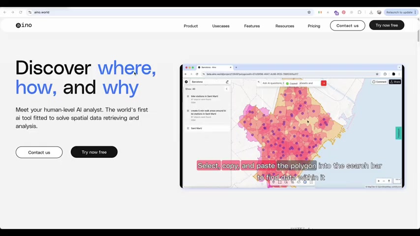
Depending on what tier of subscription users have, the degree to which they can use features such as color correction and prompt numbers will vary. Some of these tiers also include specialized support.








Most people like





































Report
Please select a reason for reporting
- 13 Reasons to Switch from Snapchat to Text Messaging
- 7 Powerful Speech to Text Apps to Boost Productivity
- 10 Best Speech to Text Tools for Effortless Transcription
- 13 Free Tools to Easily Transcribe Audio to Text
- 15 Surprising Ways Google's Speech-to-Text Boosts Productivity
- 7 Best Free Online Audio to Text Transcription Tools
- 9 Tips to Transcribe Speech to Text Faster and Better
- 13 Best Speech to Text Software for Windows 10 in 2023
- 7 Tips for Choosing the Best Transcriber for Audio to Text
- 11 Reasons Why Dragon Speech-to-Text Apps are Game-Changers
- 6 Secrets to Enhance Your Speech to Text Transcription
- 6 Brilliant Ways to Boost Productivity with Talk-to-Text on Your MacBook
- 6 Ways Transcription Software Converts Audio to Text
- 8 Tips to Transcribe Speech to Text Like a Pro
- 6 Reasons IBM Watson Speech to Text is a Game-Changer
- 14 Powerful Ways Talk-to-Text Improves Your Workflow
- 12 Top Windows Speech-to-Text Software for Efficient Transcription
- 12 Game-Changing Benefits of Apple's Speech to Text Technology
- 9 Powerful Use Cases for AWS Speech to Text Technology
- 10 Easy Steps to Transcribe YouTube Videos to Text
- transcription audio en texte
- online audio transcription
- free audio file transcription
- free ai audio transcription
- audio transcription service
- audio transcription online free
- audio transcription free online
- audio to transcription software
- audio and transcript
- ai audio transcription free
- voice recording to text converter
- translate voice recording to text
- record voice to text
- audio recording to text converter
- voice recording and transcription
- chatgpt voice to text
- gmail voice to text
- speech to text reader
- speech to text ai free
- speech to talk
- How SEO and Marketing Dashboards Empower Agencies to Drive Results
- How to Use AI Tools to Find Internal Linking Opportunities Across a Business Website
- Discover Your Perfect Haircut with AI Hairstyle Apps
- Free Reputation Calculator Tools: How They're Adapting to Score AI Visibility, Not Just Rankings
- Design Professional Flyers for Free on Your Phone
- Best Free Flyer Maker Apps for Android: Design Like a Pro
- How to Know If Your Business Is Ready for an AI Customer Service Agent
- Revolutionizing Storytelling: From Novels to Screenplays with AI
- Create Engaging Animated Explainer Videos with a Free AI Tool
- Stop Multi-Subscribing: Benchmark Top AI Visual Models in One Canvas
- My Brand New Logo: AI-Powered Logo Design for Startups
- Create Stunning Logos with Free AI Logo Generator!
- AI Logo Maker: Design a Stunning Logo in Minutes
- Elevate Your Zoom Experience with Enhanced Name Tags by Warmly
- Top 5 AI Logo Makers in 2025: Design a Stunning Brand
- Creative Fabrica's AI Tools: Flow, Studio, and Font Generator
- Create Stunning Logos with Canva's Free AI Logo Generator
- Create Professional and Memorable Logos with LogoMaker.ai
- Design Your Own Font: A Step-by-Step Guide with Vectornator Pro
- AI Font Generator: Revolutionizing Typeface Design with AI

Copyright ©2026 toolify