































Table of Contents
- Key Points
- Understanding Wildlife Data Management Challenges
- Developing a Python Script for Data Conversion and Appending
- How to Implement the Automated Workflow
- Cost Considerations
- Advantages and Disadvantages of Using ArcGIS and Python
- Key Features of the Python Script
- Real-World Applications of Wildlife Data Management
- FAQ
- Related Questions


Understanding Wildlife Data Management Challenges
The Inefficiency of Manual Data Handling
Wildlife biologists often collect GPS data from radio collars attached to animals.
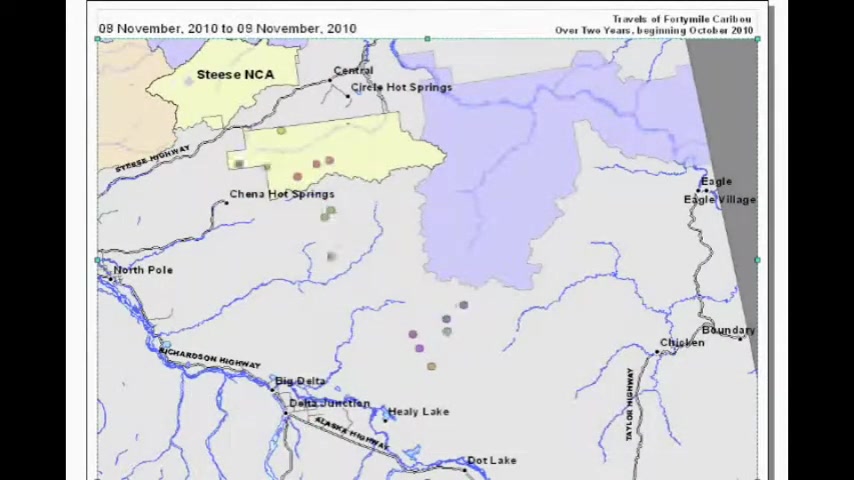
This data typically arrives monthly on CDs as CSV files. Manually appending these files into a master database is tedious and prone to errors. The need for a streamlined process is paramount for efficient data analysis and conservation planning. Effective data management is key to understanding animal behavior and habitat use. Wildlife data management involves considerable difficulties when attempting to manually compile everything. It involves the collation of individual animal location data obtained every month, leading to slow processing speeds and difficulty in real-time assessments. These factors, among others, hinder the efforts of conservation experts and those working in wildlife management.
Why Automate Data Management with ArcGIS and Python?
ArcGIS is a powerful GIS (Geographic Information System) platform used for spatial data analysis and mapping. Python scripting within ArcGIS allows for automation of repetitive tasks and customization of workflows. By combining these tools, biologists can significantly reduce the time and effort required to manage and analyze wildlife tracking data. Python is well-suited for ArcGIS data projects that are more complex than the regular options and functions that are already available in the interface. It is often used when regular interface options do not offer much and when there is need to do repetitive tasks. It is often much better and easier to make a Python script that runs and automates a project for you. The integration of ArcGIS with Python can allow for great control when importing and maintaining the GIS data.
Developing a Python Script for Data Conversion and Appending
Step-by-Step Script Development
The core of the automated process involves a Python script that performs several key tasks:
- File Preparation:
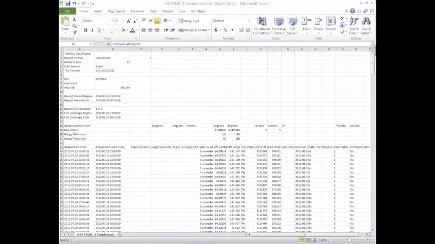
The script begins by preparing the CSV files received from the Telonics data converter. This involves extracting essential information such as collar ID and Argos ID, which uniquely identify each animal.
- Data Formatting: The script formats the data, ensuring that each record contains the necessary attributes for spatial analysis. This includes creating new columns for collar ID and Argos ID, and structuring the data in a way that ArcGIS can easily interpret.
- Spatial Integration: The formatted data is then integrated into ArcGIS. The script uses the 'MakeXYEventLayer' tool to convert the GPS coordinates into spatial point features. This step is crucial for visualizing and analyzing animal locations on a map.
- Data Appending: Finally, the script appends the newly created point features into a master geodatabase. This ensures that all monthly data is consolidated into a single, comprehensive dataset. The master dataset will be the compilation of all of the data you were importing.
- Data Filtering: The data is also filtered through the script to get rid of all the unneeded or unsuccessful data points from the GPS.
This automated workflow significantly reduces manual effort and ensures data consistency across multiple datasets.
Key Code Snippets and Explanation
Here are some key snippets from the Python script, along with explanations:
import arcpy
import os

inFolder = arcpy.GetParameterAsText(0)

arcpy.env.overwriteOutput = True
outGdb = arcpy.GetParameterAsText(1)
outPath = os.path.dirname(outGdb)
outName = os.path.basename(outGdb)

lstcsv = glob.glob(inStr)

OutFGdb = arcpy.CreateFileGDB_management(outPath, outName, "CURRENT")arcpy: Imports the ArcGIS Python module.os: Imports the operating system module for file path manipulation.inFolder: Defines the input folder containing the CSV files.arcpy.env.overwriteOutput = True: Allows overwriting existing files.OutFGdb: Creates a new file geodatabase to store the data.
for file in lstcsv:
    filename = file.rsplit('\\',1)
    outname = filename[1].replace(".csv",'')

event = arcpy.MakeXYEventLayer_management(file, "GPSLongitude", "GPSLatitude", outshp,GEOG)

    arcpy.Append_management (selection,OutMasterFC,"NO_TEST")
arcpy.AddMessage("DONE")MakeXYEventLayer_management: Converts CSV records to spatial points.arcpy.Append_management: Appends the points to the master feature class.
These snippets showcase the power of Python to automate complex GIS tasks, saving time and reducing errors.
How to Implement the Automated Workflow
Setting Up the ArcGIS Environment
Before running the script, ensure you have ArcGIS installed and configured correctly. This includes setting up the Python environment and installing any necessary libraries. Then, import the arcpy packages for use with ArcGIS. It is important to make sure all filepaths used to import the data are exact, or the script will not run properly.
Running the Python Script within ArcGIS
To run the script:
- Open ArcGIS Pro: Launch ArcGIS Pro and open your project.
- Access the Python Window: Open the Python window within ArcGIS Pro.
- Load the Script: Load your Python script into the Python window.
- Set Parameters:
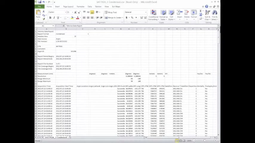
Define the input folder containing your CSV files and the output geodatabase where the data will be stored.
- Execute the Script: Run the script. ArcGIS will process the data, convert it to spatial features, and append it to the master geodatabase.
Key Features of the Python Script
Data Conversion and Spatial Integration
The Python script offers robust data conversion capabilities, efficiently transforming CSV files into ArcGIS-compatible spatial data. This process involves:
- Extracting essential data fields like collar ID, Argos ID, GPS latitude, and GPS longitude.
- Automating the conversion of GPS coordinates into point features using the 'MakeXYEventLayer' tool.
- Filtering the data to include only points with successful GPS fixes.
This ensures the data is readily available for spatial analysis and visualization.
Automated Data Appending
The automated data appending feature saves significant time by consolidating monthly data into a single, comprehensive master geodatabase. This process includes:
- Iterating through multiple CSV files in a specified folder.
- Appending the formatted data into a master feature class using the 'Append_management' tool.
- Ensuring consistent data structure across all appended datasets.
Custom Tool Creation
The Python script enables the creation of custom ArcGIS tools tailored to specific wildlife data management needs. This involves:
- Packaging the script into a toolbox that can be easily shared and used by other biologists and conservationists.
- Defining parameters within the script that allow users to specify input folders, output geodatabases, and other relevant settings.
This facilitates accessibility and simplifies the data management process for users with varying levels of GIS expertise.
Data Preparation for Animation
The final product is an updated geodatabase.
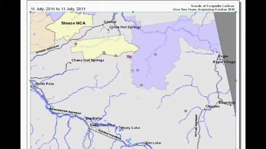
This view shows approximately 50,000 locations of caribou. Prepare and filter data for seamless animation of animal movement patterns. This includes:
- Filtering out unsuccessful GPS fixes, ensuring accurate animation.
- Formatting date and time fields to facilitate time-series analysis.
With the improved workflow the process becomes easier to generate captivating visuals of animal movement.








Most people like


































Report
Please select a reason for reporting
- 13 Reasons to Switch from Snapchat to Text Messaging
- 7 Powerful Speech to Text Apps to Boost Productivity
- 10 Best Speech to Text Tools for Effortless Transcription
- 13 Free Tools to Easily Transcribe Audio to Text
- 15 Surprising Ways Google's Speech-to-Text Boosts Productivity
- 7 Best Free Online Audio to Text Transcription Tools
- 9 Tips to Transcribe Speech to Text Faster and Better
- 13 Best Speech to Text Software for Windows 10 in 2023
- 7 Tips for Choosing the Best Transcriber for Audio to Text
- 11 Reasons Why Dragon Speech-to-Text Apps are Game-Changers
- 6 Secrets to Enhance Your Speech to Text Transcription
- 6 Brilliant Ways to Boost Productivity with Talk-to-Text on Your MacBook
- 6 Ways Transcription Software Converts Audio to Text
- 8 Tips to Transcribe Speech to Text Like a Pro
- 6 Reasons IBM Watson Speech to Text is a Game-Changer
- 14 Powerful Ways Talk-to-Text Improves Your Workflow
- 12 Top Windows Speech-to-Text Software for Efficient Transcription
- 12 Game-Changing Benefits of Apple's Speech to Text Technology
- 9 Powerful Use Cases for AWS Speech to Text Technology
- 10 Easy Steps to Transcribe YouTube Videos to Text
- transcription audio en texte
- online audio transcription
- free audio file transcription
- free ai audio transcription
- audio transcription service
- audio transcription online free
- audio transcription free online
- audio to transcription software
- audio and transcript
- ai audio transcription free
- voice recording to text converter
- translate voice recording to text
- record voice to text
- audio recording to text converter
- voice recording and transcription
- chatgpt voice to text
- gmail voice to text
- speech to text reader
- speech to text ai free
- speech to talk
- How to Use AI Tools to Find Internal Linking Opportunities Across a Business Website
- Discover Your Perfect Haircut with AI Hairstyle Apps
- Free Reputation Calculator Tools: How They're Adapting to Score AI Visibility, Not Just Rankings
- Design Professional Flyers for Free on Your Phone
- Best Free Flyer Maker Apps for Android: Design Like a Pro
- How to Know If Your Business Is Ready for an AI Customer Service Agent
- Revolutionizing Storytelling: From Novels to Screenplays with AI
- Create Engaging Animated Explainer Videos with a Free AI Tool
- Stop Multi-Subscribing: Benchmark Top AI Visual Models in One Canvas
- Best Seedance 2.5 API Provider: Every Price on the Market, Checked at Source
- Top AI Social Media Management Tools: Automate Your Content Strategy
- Free AI Text to Video Generator: Create Stunning Videos from Text
- Discover 17 ChatGPT Alternatives: A Comprehensive Comparison
- Character.AI vs. Janitor AI: Which AI Chat Platform Reigns Supreme?
- Top Virtual Assistant Companies in 2026: Reviews, Pricing, and Plans Compared
- Unveiling FaceCheck.ID: Revolutionizing Reverse Image Searches with AI
- 11 Best AI Dialers in 2026: Features, Pricing, Pros and Cons
- How I Direct Consistent AI Clips: A Hands-On Guide to Multi-Model Generation
- A Realistic Review of the Photo Generator Image Tool
- Playwright MCP Server: Automated Web Testing with Agent Mode

Copyright ©2026 toolify